
Certification: EADA
Certification Full Name: Esri Certified ArcGIS Desktop Associate
Certification Provider: Esri
Exam Code: EADA105
Exam Name: ArcGIS Desktop Associate 10.5
Product Screenshots


How to Become an ESRI EADA Certified Professional
Spatial analysis lies at the core of the ESRI EADA certification. The ability to interpret, manipulate, and synthesize geographic data is what differentiates proficient GIS professionals from casual users. Spatial analysis is not simply about plotting points on a map; it is about extracting patterns, trends, and relationships hidden within layers of data. It requires a keen sense of observation and an understanding of underlying geographic principles that govern the natural and built environment.
A key aspect of mastering spatial analysis is familiarity with geoprocessing tools. Candidates must become comfortable using buffers, overlays, spatial joins, and network analysis functions. Each tool, when applied correctly, reveals dimensions of information that are otherwise imperceptible. For example, buffering a water body can help determine flood risk zones, while network analysis can optimize the layout of transportation routes. These exercises encourage a methodical mindset, where every action is guided by both a logical framework and a strategic objective.
Another crucial dimension is proficiency in raster analysis. Raster data, representing continuous surfaces like elevation, temperature, or population density, requires distinct analytical approaches compared to vector data. Professionals must navigate cell-based calculations, map algebra, and surface modeling techniques to derive meaningful insights. Mastery of these processes equips candidates to tackle complex environmental, social, and infrastructural problems, reinforcing the analytical rigor demanded by the certification.
Moreover, spatial statistics introduces a quantitative layer to analysis. Concepts like spatial autocorrelation, hot spot detection, and regression modeling enhance decision-making capabilities. Rather than merely visualizing phenomena, GIS professionals can measure their intensity, predict outcomes, and identify anomalous patterns. Integrating these statistical techniques with ESRI’s toolsets allows for a more holistic approach to spatial problem solving, ensuring that analyses are both accurate and actionable.
Practical exercises play a pivotal role in developing these skills. Engaging with real-world datasets exposes candidates to messy, imperfect data, reflecting true challenges encountered in professional environments. Handling projection mismatches, inconsistent attribute tables, or incomplete metadata sharpens problem-solving acumen. These experiences cultivate resilience and adaptability, traits that are essential for advanced GIS practice and successful navigation of the EADA certification pathway.
Geodatabase Design and Management
A solid understanding of geodatabase structures is another pillar of the ESRI EADA certification. Geodatabases are more than storage systems; they are organizational frameworks that dictate how spatial and attribute data interact, maintain integrity, and scale across projects. Designing efficient geodatabases demands insight into data types, relational structures, topology rules, and indexing strategies. Candidates who grasp these concepts can ensure that datasets remain reliable, searchable, and conducive to advanced analysis.
Enterprise geodatabases present an additional layer of complexity. These systems allow multiple users to access, edit, and query data concurrently, making them indispensable for large-scale projects. Managing such environments requires knowledge of versioning, permissions, and conflict resolution. Professionals must anticipate data conflicts and design workflows that minimize disruptions, ensuring smooth collaboration across departments or agencies.
Metadata management is equally important. Properly documented data improves usability, supports compliance, and reduces ambiguity. Understanding metadata standards, such as documenting coordinate systems, data lineage, and attribute definitions, ensures that datasets retain clarity and accuracy over time. ESRI emphasizes these best practices, making them a critical focus of the EADA curriculum.
Additionally, performance optimization cannot be overlooked. As datasets grow in volume and complexity, professionals must deploy strategies to maintain efficiency. Indexing fields, reducing redundancy, and selecting appropriate storage formats improve query speeds and analysis outcomes. Mastery of these principles reflects not just technical capability, but strategic thinking, a quality that distinguishes advanced GIS practitioners.
Leveraging GIS for Decision Support
GIS extends far beyond map creation; it is a decision-support engine. The ESRI EADA certification reinforces this perspective by emphasizing the translation of geospatial data into actionable intelligence. Organizations increasingly rely on GIS to guide policy, resource allocation, and operational planning. Candidates must develop the ability to interpret complex datasets and recommend solutions based on spatial evidence.
Scenario modeling exemplifies this principle. Professionals may be asked to optimize emergency response routes, identify areas susceptible to environmental hazards, or simulate urban growth trends. These tasks require integrating multiple layers, performing predictive analysis, and visualizing outcomes in a manner that is both accurate and persuasive. The capacity to communicate findings effectively to stakeholders adds another dimension to GIS proficiency, blending technical expertise with strategic insight.
Decision support also involves integrating non-spatial data. Demographics, economic statistics, and environmental indicators enrich spatial models, offering multidimensional perspectives on problems. Professionals must navigate the interplay between spatial and non-spatial data, ensuring that analyses reflect real-world complexity. The EADA curriculum’s emphasis on such integrative thinking prepares candidates to address multifaceted challenges with confidence and creativity.
Furthermore, GIS professionals must be adept at scenario comparison and sensitivity analysis. By altering variables, testing assumptions, and evaluating outcomes, candidates develop foresight into the potential consequences of decisions. This analytical flexibility is invaluable, especially in sectors where uncertainties, such as climate variability or population shifts, can drastically influence outcomes.
Implementing Advanced Analytical Workflows
Advanced GIS workflows underpin many of the competencies tested in the ESRI EADA certification. These workflows combine multiple processes, from data preparation to final visualization, ensuring that analysis is rigorous, reproducible, and insightful. A well-structured workflow reduces errors, streamlines project execution, and enhances credibility.
Automation represents a critical component of advanced workflows. Utilizing scripting languages, model builders, and batch processing tools enables professionals to execute repetitive tasks efficiently. Automation also supports complex analyses that would be impractical manually, such as temporal simulations or large-scale spatial interpolations. Mastery of these methods signals not only technical expertise but also a strategic approach to problem solving.
Another dimension is quality assurance. Professionals must implement validation routines, error checking, and cross-verification techniques to maintain data integrity. In high-stakes applications, such as disaster management or infrastructure planning, accuracy is paramount. The EADA certification emphasizes this responsibility, cultivating meticulous attention to detail alongside analytical prowess.
Workflow documentation further enhances professional competence. By recording methods, assumptions, and results, GIS specialists facilitate knowledge transfer, reproducibility, and accountability. Documented workflows also support training initiatives and collaborative projects, allowing teams to build upon established practices rather than reinvent processes repeatedly.
Visualization techniques amplify the impact of analytical workflows. Beyond standard maps, professionals create interactive dashboards, thematic renderings, and dynamic representations of spatial phenomena. These visualizations transform abstract datasets into intuitive, communicable insights, bridging the gap between technical analysis and decision-making audiences.
Engaging with Emerging Geospatial Technologies
The ESRI EADA certification prepares candidates for a landscape that is continually evolving. Emerging geospatial technologies redefine what is possible in GIS, and professionals who remain current gain a competitive edge. Cloud GIS, for instance, enables scalable data storage, real-time collaboration, and instant access to global datasets. Mastery of cloud-based platforms allows GIS professionals to manage complex projects seamlessly, integrating disparate data sources without traditional limitations.
Artificial intelligence and machine learning increasingly complement spatial analysis. Predictive modeling, pattern recognition, and anomaly detection leverage AI algorithms to extract deeper insights from vast datasets. EADA candidates who explore these tools develop the ability to anticipate trends, automate classification tasks, and enhance analytical precision. Integrating AI into workflows represents the next frontier in professional GIS practice, marrying traditional spatial reasoning with cutting-edge computation.
Internet of Things integration further expands GIS capabilities. Sensor networks, mobile devices, and environmental monitoring systems generate streams of real-time data. Professionals adept at harnessing these inputs can track urban dynamics, monitor ecological conditions, or support emergency response initiatives with unprecedented timeliness. The EADA certification encourages candidates to consider these possibilities, fostering adaptability and technological literacy.
Virtual and augmented reality also offer novel pathways for spatial representation. Immersive visualizations provide stakeholders with intuitive perspectives of complex projects, enhancing engagement and comprehension. By experimenting with these media, GIS professionals expand the scope of spatial communication, positioning themselves as innovative contributors in a rapidly transforming field.
Cultivating Professional Networks and Communities
While technical expertise is essential, ESRI EADA emphasizes the value of professional networks. Engaging with peer communities, attending conferences, and participating in collaborative projects amplify learning and career development. Interaction with experienced practitioners exposes candidates to diverse problem-solving strategies, real-world project scenarios, and evolving best practices.
Mentorship plays a pivotal role in professional growth. Guided support from seasoned GIS specialists accelerates skill acquisition, provides constructive feedback, and cultivates confidence. Mentors can offer insights into complex workflows, suggest study approaches, and share a nuanced understanding of organizational GIS integration. Candidates who actively seek mentorship enhance both their technical capacity and their professional resilience.
Participation in user groups and forums reinforces knowledge retention. Discussing challenges, sharing solutions, and exploring innovative techniques fosters an environment of continuous learning. These engagements also create visibility within the GIS community, establishing credibility and opening doors for collaborative opportunities.
Professional networks serve as a bridge between certification and practical application. They expose candidates to career opportunities, ongoing technological developments, and interdisciplinary projects. In essence, cultivating a network is both a strategic investment and a natural extension of the certification journey, ensuring that learning translates into tangible professional advancement.
Mastering Geospatial Reasoning
Geospatial reasoning represents a pivotal skill set for any ESRI EADA aspirant, combining analytical foresight with practical spatial understanding. It transcends the basic interpretation of maps, demanding a cognitive approach to visualize complex spatial arrangements and relationships. Professionals who excel in this domain can perceive trends and anomalies that are not immediately evident, allowing them to construct solutions to problems that blend geographic insight with actionable outcomes. The cultivation of geospatial reasoning begins with habitual interaction with diverse datasets, encouraging the brain to form spatial heuristics, recognize correlations, and anticipate the consequences of spatial changes. This skill evolves gradually, nurtured through consistent engagement with real-world scenarios, where the interplay of natural and man-made environments challenges conventional thinking.
Advanced Cartographic Techniques
Cartography remains an essential pillar in GIS expertise, extending far beyond basic map creation into the realm of visual storytelling. Effective map design demands meticulous attention to symbology, color gradients, typography, and the subtle layering of information to guide interpretation seamlessly. Each map tells a story, whether illustrating urban expansion, environmental degradation, or transportation networks. Professionals who can convey complex spatial information intuitively, while maintaining technical accuracy, command greater influence in decision-making processes. Integrating artistic sensibilities with empirical data allows maps to become instruments of persuasion, insight, and comprehension rather than static illustrations. The ability to craft compelling visual narratives from geospatial data reflects a nuanced mastery that elevates a practitioner from competent to exceptional.
Spatial Analysis and Modeling
Spatial analysis forms the intellectual bedrock for advanced GIS operations. This domain encompasses a diverse array of methodologies, from overlay and proximity analyses to network optimization and predictive modeling. ESRI EADA aspirants must internalize the logic underlying each analytical method, understanding not only how to execute operations but also when and why to apply them. Modeling complex scenarios, such as simulating urban growth, forecasting flood risks, or assessing ecosystem vulnerability, requires practitioners to interlace multiple layers of information with precision and foresight. Regular practice with heterogeneous datasets sharpens analytical acumen, enabling professionals to identify latent patterns, quantify spatial relationships, and deliver solutions that are robust, scalable, and defensible. The true proficiency lies in integrating these techniques into coherent, adaptable workflows that address multifaceted real-world challenges.
Geodatabase Management Proficiency
A profound understanding of geodatabases distinguishes a certified professional from a casual GIS user. Geodatabases act as repositories of structured spatial information, demanding careful planning and meticulous upkeep. Proficiency in designing feature classes, establishing topological rules, defining domains, and managing subtypes ensures that datasets remain consistent, reliable, and accessible. In enterprise contexts, versioning and replication become critical, allowing multiple stakeholders to interact with data without introducing errors or inconsistencies. Moreover, grasping the fundamentals of database architecture, normalization, and indexing empowers professionals to handle large-scale, heterogeneous datasets efficiently. A well-maintained geodatabase is not merely a storage solution—it is a dynamic framework that underpins analysis, visualization, and operational decision-making across projects.
Integrating Spatial and Non-Spatial Data
Modern GIS practice necessitates the integration of spatial datasets with non-spatial information. Projects rarely exist in isolation, often requiring demographic, economic, environmental, or logistical datasets to create a holistic understanding of a scenario. Proficiency in joining, querying, and manipulating relational tables enables professionals to perform attribute-based analyses that generate actionable insights. For instance, linking transportation network data with population density statistics can reveal critical gaps in urban planning, while combining ecological surveys with hydrological data can support conservation strategies. The capacity to merge diverse datasets not only enhances analytical rigor but also equips practitioners with the ability to craft comprehensive reports, influence policy, and provide solutions grounded in multidimensional understanding.
Hands-On Project Simulation
Active, experiential learning is the cornerstone of expertise. Hands-on project simulation allows candidates to bridge the gap between theoretical knowledge and practical application. Engaging with exercises such as urban suitability assessments, flood risk mapping, logistics optimization, or ecological impact modeling cultivates technical agility and critical problem-solving capabilities. Each simulated project hones efficiency, builds confidence, and instills resilience against unexpected challenges. Repetition across varied scenarios encourages adaptability, enabling professionals to transfer skills seamlessly across domains. The cumulative experience fosters an intuitive understanding of spatial dynamics, empowering individuals to anticipate consequences, refine strategies, and implement solutions with precision.
Developing Spatial Intuition
Spatial intuition is an advanced, often underappreciated skill that complements analytical ability. It involves cultivating an instinctive sense of spatial relationships, pattern recognition, and potential anomalies within datasets. Unlike rote computation, spatial intuition allows professionals to predict the impact of changes, identify inconsistencies, and propose innovative interventions. This capacity emerges from sustained interaction with real-world spatial data and a reflective approach to problem-solving. Experts with refined spatial intuition can navigate complex environments, foresee challenges before they manifest, and synthesize information into actionable insights that influence outcomes decisively. The development of this skill differentiates top-tier ESRI EADA-certified professionals, enabling them to operate with strategic foresight and precision.
Understanding the Core Concepts of Geospatial Analysis
Mastering the EADA exam demands a profound grasp of geospatial principles. Candidates must immerse themselves in the nuances of spatial data structures, coordinate systems, and projection techniques. This foundational knowledge underpins the ability to interpret complex datasets and make informed analytical decisions. Delving into vector and raster paradigms, understanding topology rules, and recognizing the implications of spatial resolution equips professionals with the cognitive toolkit needed to approach advanced scenarios with confidence.
Analytical rigor is enhanced when learners dissect case studies, identifying the interplay between environmental variables, urban planning elements, and demographic patterns. Observing how data flows from raw acquisition to final visualization cultivates an appreciation for the entire geospatial workflow. By internalizing these processes, candidates gain the dexterity to anticipate challenges, optimize data handling, and apply appropriate analytical methods without hesitation.
Beyond technical comprehension, a conceptual mindset helps candidates connect geospatial theory to tangible outcomes. The ability to reason through spatial relationships, predict patterns, and evaluate the significance of anomalies transforms rote knowledge into actionable intelligence. It is this transition from understanding to strategic application that distinguishes high-performing candidates in the EADA certification.
Enhancing Practical Skills Through Immersive Exercises
Practical mastery is achieved through deliberate, hands-on exercises that simulate real-world challenges. Candidates benefit from meticulously recreating project workflows, experimenting with data manipulation, and testing alternative analytical approaches. By repeatedly engaging with tasks such as feature class creation, topology validation, and geodatabase normalization, professionals solidify muscle memory while reinforcing conceptual understanding.
Incorporating scenario-driven exercises fosters adaptability. For instance, candidates might explore flood risk mapping, urban heat analysis, or transportation network optimization. Each scenario encourages the integration of multiple tools, forcing candidates to make strategic decisions about methodology, data sources, and performance optimization. This type of immersive practice cultivates problem-solving agility, a trait essential for navigating the dynamic demands of the EADA exam.
Attention to detail during exercises cannot be overstated. Meticulous documentation of workflows, annotation of analytical steps, and careful tracking of assumptions enhance clarity and reduce errors. These habits translate seamlessly to exam conditions, where precision and efficiency are critical. Over time, repeated exposure to practical exercises generates confidence, reduces cognitive load during assessments, and solidifies an intuitive sense of geospatial processes.
Leveraging Analytical Tools with Precision
EADA preparation involves more than conceptual knowledge—it requires mastery of analytical instruments and software capabilities. Candidates should develop fluency with tools for spatial querying, geoprocessing, and data visualization. Understanding the underlying mechanics of these tools allows professionals to execute operations with precision, identify subtle data inconsistencies, and streamline workflows for optimal performance.
Integration of automation techniques, such as model builder workflows or script-based processing, accelerates task completion while demonstrating proficiency in advanced functionalities. Candidates who can anticipate errors, apply corrective operations efficiently, and adapt tools to diverse datasets gain a competitive edge. In addition, familiarity with customization and parameter optimization enhances both speed and analytical insight, reinforcing the candidate’s capacity to handle high-stakes exam scenarios.
Analytical tool mastery also extends to visualization strategies. Candidates should practice generating maps that are not only accurate but also communicative, effectively conveying patterns, trends, and anomalies. Crafting clear, informative visuals ensures that analytical conclusions are both defensible and interpretable, a skill that bridges the gap between technical execution and professional application.
Building Cognitive Endurance and Exam Resilience
Long-term success in EADA preparation hinges on sustained cognitive endurance. The capacity to maintain focus over extended study periods, absorb complex material, and execute intricate analyses under pressure is cultivated through structured routines. Incremental exposure to challenging content, spaced repetition of core principles, and progressive engagement with practical scenarios build mental stamina while reinforcing knowledge retention.
Mindfulness techniques, such as short periods of focused attention, controlled breathing, and reflective pauses, enhance concentration and reduce cognitive fatigue. Candidates who adopt these practices often find they can maintain clarity during long problem-solving sessions and remain resilient when confronted with unexpected complications. Strategic breaks, coupled with goal-oriented study sessions, prevent burnout and promote consistent progress.
Resilience also manifests in the candidate’s response to mistakes. Viewing errors as diagnostic tools rather than setbacks encourages adaptive learning. Careful review of missteps, paired with iterative practice, transforms weaknesses into strengths. This approach cultivates a mindset that thrives under pressure, equipping candidates to approach the EADA exam with confidence and composure.
Cultivating Professional Insight Through Community Engagement
Interaction with the broader geospatial community enriches preparation beyond textbooks and exercises. Participating in forums, discussion groups, and workshops exposes candidates to diverse perspectives, innovative methodologies, and real-world problem-solving strategies. Observing how seasoned professionals tackle challenges cultivates intuitive judgment, a form of insight that accelerates decision-making during high-stakes examinations.
Networking with peers and mentors fosters collaborative learning. Engaging in knowledge exchange encourages the exploration of novel techniques, the refinement of workflows, and the acquisition of practical shortcuts. Additionally, exposure to emerging trends, software updates, and best practices provides a forward-looking perspective, equipping candidates with insights that extend beyond the immediate goal of certification.
Through active engagement, candidates develop professional awareness, an understanding of industry norms, and an appreciation for ethical considerations in geospatial analysis. These attributes enhance analytical judgment and support holistic thinking, strengthening the ability to synthesize data, interpret patterns, and present findings responsibly and effectively.
Mastering Time Management and Strategic Task Execution
Effective time management is a cornerstone of EADA exam success. Candidates must cultivate the ability to allocate effort judiciously, prioritize complex tasks, and maintain pace without compromising accuracy. Practicing time-bound exercises, segmenting problems into manageable components, and anticipating areas of difficulty builds an internal rhythm that mirrors exam conditions.
Strategic task execution involves assessing the relative weight and complexity of each problem, determining the most efficient approach, and deploying resources accordingly. Mastery of tool shortcuts, automation scripts, and optimized workflows reduces operational overhead, freeing cognitive resources for analytical thinking. Candidates who internalize these strategies experience smoother, more confident exam performance and avoid unnecessary stress.
Equally important is adaptability. Even the most carefully crafted plan may encounter unforeseen challenges. Candidates who remain flexible, recalibrate their approach, and respond swiftly to changing circumstances maintain momentum and reduce the risk of errors. Over time, consistent practice in strategic execution develops intuition, enabling professionals to navigate complex assessments with agility and precision.
Sustaining Motivation and Cultivating a Growth Mindset
Maintaining motivation throughout preparation is essential for consistent progress. Candidates benefit from setting incremental goals, celebrating milestones, and recognizing achievements in both theoretical and practical domains. This reinforcement fosters a sense of accomplishment, sustaining engagement and energizing continued effort.
A growth mindset amplifies this motivation. Viewing preparation as an iterative process of skill enhancement rather than a linear challenge encourages curiosity, experimentation, and resilience. Candidates who embrace challenges as opportunities for growth, rather than sources of stress, develop a deeper, more enduring mastery of geospatial principles and analytical techniques.
In addition, cultivating intrinsic motivation, rooted in professional aspirations and personal curiosity, strengthens the connection between effort and outcome. By aligning preparation with meaningful objectives, candidates sustain focus, overcome setbacks with determination, and approach the EADA exam with both confidence and enthusiasm.
Urban Planning and Sustainable Development
Urban planning has evolved far beyond conventional maps and zoning regulations. Today, the integration of geospatial intelligence empowers city planners to make decisions grounded in empirical evidence rather than intuition alone. EADA-certified professionals harness the potential of ESRI platforms to analyze urban expansion, infrastructure demands, and demographic trends with remarkable precision. Through geospatial modeling, they anticipate the evolution of neighborhoods, ensuring that growth is balanced with ecological sustainability.
Land use analysis forms a cornerstone of modern urban development. By mapping the distribution of residential, commercial, and industrial zones, planners can predict areas prone to congestion or underutilization. EADA skills allow professionals to examine multi-layered datasets, such as population density, economic activity, and environmental constraints, synthesizing complex information into actionable insights. The result is a cityscape that balances human needs with environmental preservation, reducing the risks of urban sprawl and resource depletion.
Transportation systems are also profoundly influenced by spatial analysis. Certified professionals utilize ESRI tools to simulate traffic flows, evaluate transit networks, and optimize public transport routes. These analyses identify bottlenecks, forecast future demands, and propose interventions that enhance mobility. Cities benefit from reduced congestion, lower carbon emissions, and improved accessibility, demonstrating how GIS expertise directly translates into tangible societal gains.
Moreover, sustainable urban development relies on predictive modeling of environmental impacts. By assessing flood zones, heat islands, and pollution patterns, EADA professionals inform infrastructure projects that mitigate risks and enhance resilience. Their work ensures that the built environment coexists harmoniously with natural systems, fostering cities that are not only functional but also livable and enduring.
Environmental Management and Conservation
Environmental stewardship is increasingly dependent on sophisticated data analysis. EADA-certified specialists play a critical role in monitoring ecosystems, modeling environmental changes, and informing conservation strategies. Their expertise allows organizations to interpret complex spatial data, enabling proactive interventions that safeguard both human and ecological communities.
One of the pivotal applications lies in deforestation tracking. By analyzing satellite imagery and temporal land cover data, professionals can identify areas of rapid forest loss and prioritize reforestation initiatives. Spatial modeling also supports biodiversity conservation by mapping habitats, migration corridors, and ecological networks. Such insights allow conservationists to allocate resources effectively, ensuring that interventions yield measurable ecological benefits.
Climate change mitigation and adaptation are further domains where EADA skills prove indispensable. Certified professionals simulate environmental scenarios, such as rising sea levels, shifting rainfall patterns, and temperature fluctuations, to guide policy and investment decisions. By integrating hydrological models, terrain analysis, and population vulnerability assessments, GIS experts provide actionable frameworks for minimizing ecological disruption and enhancing societal resilience.
Water resource management is another critical application. Professionals use geospatial data to monitor river basins, groundwater reserves, and watershed health, predicting areas susceptible to scarcity or contamination. By visualizing complex hydrological interactions, decision-makers can implement strategies for sustainable water use, ensuring equitable access and long-term ecological balance.
Additionally, environmental risk assessment benefits from EADA-certified expertise. By analyzing topography, land cover, and climate variables, professionals identify regions vulnerable to erosion, landslides, and other natural hazards. The resulting insights enable preemptive interventions, reducing environmental damage and protecting communities. The integration of spatial intelligence in conservation and resource management demonstrates the transformative impact of GIS mastery on ecological sustainability.
Transportation and Logistics Optimization
Modern logistics and transportation networks demand efficiency, precision, and adaptability. EADA-certified professionals bring a unique capability to transform raw spatial data into operational strategies that reduce costs and improve service delivery. Their work underpins decisions in route optimization, supply chain management, and service accessibility, creating tangible advantages for businesses and communities alike.
Route optimization is a primary application of geospatial intelligence in transportation. By analyzing road networks, traffic patterns, and delivery points, professionals identify the most efficient paths for vehicles, minimizing travel time and fuel consumption. This has direct economic benefits, lowering operational expenses while enhancing service reliability. The ability to simulate different scenarios, such as peak-hour congestion or infrastructure disruptions, adds strategic foresight to logistical planning.
Network analysis extends beyond roads to public transit and pedestrian mobility. EADA specialists model service areas, transit connectivity, and accessibility to essential facilities, providing insights that inform urban mobility strategies. By understanding how people move through space, planners can design interventions that enhance accessibility, reduce inequities, and support sustainable transportation options.
Supply chain management also benefits from spatial intelligence. Geospatial data enables organizations to track inventory distribution, monitor shipment routes, and forecast delivery timelines. By integrating GIS analytics with operational systems, businesses achieve higher efficiency and responsiveness, ensuring that goods reach their destinations reliably. This integration of spatial data into logistics demonstrates the practical power of ESRI EADA skills in real-world problem solving.
Disaster resilience within transportation networks further showcases the versatility of geospatial expertise. Professionals simulate the impact of natural events such as floods or earthquakes on infrastructure, identifying critical nodes and contingency routes. This proactive approach minimizes disruption, protects resources, and supports rapid recovery, reinforcing the essential role of certified professionals in creating robust and adaptive transport systems.
Disaster Response and Risk Management
In the realm of emergencies, timely information is the difference between chaos and coordinated action. ESRI EADA-certified professionals provide the analytical foundation necessary for effective disaster response, integrating data, predictive models, and visualization techniques to support decision-making under pressure. Their contributions extend across risk assessment, emergency planning, and real-time operational support.
Hazard mapping is a central tool in disaster preparedness. Professionals use geospatial analysis to identify regions prone to floods, earthquakes, landslides, or wildfires, enabling authorities to prioritize mitigation measures. By overlaying population density, infrastructure vulnerability, and historical incident data, GIS experts generate actionable risk profiles, informing strategic investments in safety and resilience.
During emergencies, rapid data integration is critical. Certified specialists synthesize information from satellites, sensors, and field reports to create a comprehensive situational overview. This allows emergency managers to allocate resources effectively, coordinate response teams, and communicate accurate information to the public. The precision and speed of spatial analysis directly enhance the effectiveness of life-saving interventions.
Predictive modeling further augments disaster management. By simulating potential scenarios, professionals anticipate the spread of hazards, evaluate secondary effects, and propose mitigation strategies. For example, flood modeling can determine which communities are likely to experience inundation, guiding evacuations and resource deployment. Such foresight reduces casualties and economic losses, emphasizing the strategic value of GIS expertise.
Post-disaster recovery planning also relies on spatial intelligence. Professionals assess infrastructure damage, identify critical supply routes, and plan reconstruction efforts that enhance long-term resilience. By embedding geospatial analysis into recovery processes, communities rebuild more efficiently and sustainably, demonstrating how EADA certification empowers professionals to create meaningful, life-saving impact.
Public Health and Epidemiology
The field of public health increasingly intersects with spatial analysis. ESRI EADA-certified professionals contribute to epidemiology, disease mapping, and healthcare planning, leveraging geospatial insights to enhance population health outcomes. Their work supports disease surveillance, resource allocation, and targeted interventions, reflecting the broader societal benefits of GIS expertise.
Disease mapping is a vital application in epidemiology. By tracking the geographic distribution of illnesses, professionals identify patterns, clusters, and transmission pathways. This information enables healthcare providers and policymakers to respond proactively, deploying resources where they are most needed. Spatial modeling also supports the assessment of environmental and social determinants of health, revealing how factors like pollution, population density, and accessibility influence disease prevalence.
Healthcare infrastructure planning benefits from EADA-certified insights. Professionals analyze the locations of hospitals, clinics, and pharmacies relative to population needs, identifying gaps in service and opportunities for improvement. By simulating patient flow, transportation access, and service utilization, planners optimize healthcare delivery, ensuring equitable access and reducing systemic inefficiencies.
Emergency health response also relies on geospatial intelligence. During outbreaks or crises, professionals integrate real-time data on infection rates, mobility patterns, and medical resources to guide interventions. Predictive modeling anticipates hotspots and potential disease spread, supporting containment strategies and minimizing public health risks.
Furthermore, public health initiatives leverage spatial data for preventive strategies. By identifying high-risk areas for chronic diseases, malnutrition, or environmental health hazards, EADA professionals guide education campaigns, vaccination programs, and policy interventions. The integration of spatial analysis in healthcare demonstrates how certified expertise extends beyond technical proficiency to tangible societal benefit, influencing lives on a broad scale.
Business Intelligence and Market Analysis
Geospatial intelligence has become a cornerstone of business strategy. ESRI EADA-certified professionals transform spatial data into insights that drive decision-making across marketing, retail, real estate, and financial services. By understanding geographic patterns of consumer behavior, resource distribution, and competitive landscapes, organizations gain a strategic advantage that is both actionable and measurable.
Retail planning exemplifies the practical applications of GIS in business. Professionals analyze demographic data, foot traffic patterns, and competitor locations to determine optimal sites for stores or service centers. This approach reduces risk, maximizes reach, and enhances customer satisfaction. Spatial modeling further allows businesses to forecast demand, anticipate market shifts, and adapt operational strategies proactively.
Market segmentation benefits from geospatial insights. By mapping customer characteristics, purchase behavior, and regional trends, EADA specialists identify niche markets and growth opportunities. These insights inform targeted campaigns, product distribution strategies, and pricing models, ensuring that businesses operate efficiently and effectively within diverse geographic contexts.
Real estate and urban development also rely heavily on GIS expertise. Professionals evaluate property values, zoning regulations, and environmental factors to guide investment decisions. By visualizing spatial relationships and predicting development trends, they enable stakeholders to make informed choices that maximize returns while minimizing risks.
Supply chain and logistics management in the private sector mirrors the applications seen in public transportation. Geospatial analysis supports route optimization, inventory distribution, and delivery efficiency, reducing costs and improving customer experience. The ability to integrate spatial intelligence into operational workflows underscores the transformative potential of ESRI EADA certification for modern enterprises.
Advanced Strategies and Best Practices in Spatial Analysis
Mastering spatial analysis is a journey that extends beyond basic proficiency. Professionals in this field must embrace a variety of advanced strategies that elevate both the quality and efficiency of their work. Automation plays a crucial role in this advancement. By creating scripts and custom workflows, analysts can handle repetitive tasks with minimal human intervention, freeing time for more critical thinking and problem-solving. Python scripting, particularly with specialized libraries for geospatial analysis, provides a framework to achieve these objectives. Professionals who can design, test, and deploy scripts gain a distinct advantage, as automation not only accelerates tasks but also reduces the likelihood of errors that can compromise results.
Developing models represents another essential practice for advanced professionals. Models enable systematic examination of complex datasets, allowing analysts to uncover patterns, relationships, and trends that might remain hidden in raw data. Model building requires a combination of domain knowledge and technical skill, and it allows for predictive analysis, scenario planning, and strategic decision-making. By establishing repeatable and transparent models, practitioners ensure that their workflows are consistent, reliable, and adaptable to evolving datasets or new project demands. This structured approach to analysis enhances both credibility and impact in professional settings.
Automation and Workflow Optimization
Automation is more than a convenience; it is a cornerstone of efficient spatial analysis. Professionals can leverage scripting to create workflows that handle large volumes of data with precision. Automation reduces manual intervention, streamlines repetitive processes, and maintains consistency across analyses. Scripting languages like Python offer the ability to manipulate datasets, execute spatial operations, and integrate multiple tools into cohesive workflows. By mastering these techniques, analysts can manage complex projects without sacrificing accuracy or timeliness. The capacity to build automated pipelines also opens opportunities for innovation, enabling the creation of tools and processes that extend beyond standard software capabilities.
Workflow optimization complements automation by ensuring that every step of a project is executed with maximum efficiency. Analysts must evaluate their procedures, identify bottlenecks, and implement methods that reduce redundant effort. Optimization involves understanding the flow of data, the interdependence of processes, and the most effective order in which tasks should be performed. This approach not only improves productivity but also enhances the reliability of outputs. Professionals who cultivate workflow optimization skills are better prepared to tackle large-scale projects and deliver high-quality results under tight deadlines.
Collaboration and Interdisciplinary Integration
The modern landscape of spatial analysis often requires collaboration across multiple disciplines. Projects may involve input from environmental scientists, urban planners, engineers, and policy analysts, each contributing unique perspectives and expertise. Successful professionals must navigate these interdisciplinary environments, translating complex geospatial data into insights that are comprehensible and actionable for diverse stakeholders. Effective communication is, therefore, a critical skill, as the ability to convey spatial information clearly can influence project outcomes and decision-making processes.
Interdisciplinary integration goes beyond communication; it requires understanding how different fields interact with spatial data. For instance, environmental scientists may provide context on ecosystem patterns, while policy analysts offer insight into regulatory frameworks. By synthesizing these perspectives, spatial analysts can generate more robust and relevant findings. Professionals who embrace collaboration also learn to adapt to evolving project requirements, accommodate new data sources, and respond to feedback constructively. This dynamic approach fosters creativity, innovation, and professional growth.
Data Integrity and Quality Assurance
Maintaining data integrity is a fundamental principle in advanced spatial analysis. Reliable outcomes depend on datasets that are accurate, complete, and well-documented. Professionals must employ rigorous quality assurance procedures to verify that their data is free from errors and inconsistencies. This includes understanding how errors propagate through analyses, performing validation checks, and ensuring that metadata standards are consistently applied. By safeguarding data integrity, analysts protect the credibility of their findings and build trust with colleagues, clients, and decision-makers.
Quality assurance extends to every stage of a project. From data collection to analysis and visualization, professionals must be vigilant in identifying potential sources of error. They must also document their processes, providing transparency that allows others to reproduce or evaluate their work. This attention to detail enhances accountability and reinforces the reputation of the analyst as a reliable source of information. In professional practice, the commitment to data quality distinguishes competent practitioners from those who merely follow procedures without ensuring precision.
Model Building and Predictive Analysis
Model building is a defining feature of advanced spatial professionals. Models allow analysts to simulate real-world phenomena, forecast trends, and evaluate potential outcomes. The process requires careful consideration of variables, relationships, and assumptions, as well as proficiency with analytical tools. Predictive models enable proactive decision-making, offering insights into scenarios that have not yet occurred. These models are invaluable for planning, risk assessment, and resource management, providing stakeholders with actionable intelligence grounded in robust analysis.
The effectiveness of model building depends on both technical skill and conceptual understanding. Analysts must select appropriate methodologies, test their assumptions, and continually refine models based on feedback and new data. Predictive analysis also benefits from iterative approaches, where models evolve in response to observed patterns and emerging trends. Professionals who excel in model building contribute significant strategic value to their organizations, as their analyses inform decisions that affect operational efficiency, financial outcomes, and long-term planning.
Continuous Learning and Professional Development
The field of spatial analysis is dynamic, with software, techniques, and standards continually evolving. Professionals must commit to ongoing learning to remain effective and competitive. This may involve participating in training sessions, attending workshops, exploring new analytical methods, or engaging with the latest research in the discipline. Continuous learning ensures that practitioners are familiar with emerging technologies and can apply innovative approaches to complex problems.
Professional development also encompasses the cultivation of soft skills, such as communication, problem-solving, and critical thinking. These skills enhance the ability to interpret data, collaborate with colleagues, and present findings in meaningful ways. Lifelong learning instills confidence and adaptability, allowing professionals to navigate challenges, anticipate changes in the field, and seize opportunities for advancement. Those who embrace continuous education develop a versatile skill set that distinguishes them in competitive professional environments.
Strategic Decision-Making and Applied Insights
Advanced spatial analysis is ultimately about creating actionable insights. Analysts transform raw data into knowledge that supports strategic decisions and informs practical solutions. This requires more than technical expertise; it demands a deep understanding of the context in which analyses are applied. Professionals must consider the implications of their findings, evaluate the reliability of models, and align recommendations with organizational goals. By providing decision-makers with clear, evidence-based insights, spatial analysts drive outcomes that are both efficient and effective.
Applied insights also involve bridging the gap between theory and practice. Analysts must translate complex spatial patterns into comprehensible narratives that guide action. This translation process requires careful judgment, a nuanced understanding of data, and the ability to anticipate the consequences of decisions. Professionals who master this skill add significant value, ensuring that their work has tangible impacts on planning, policy, and operational execution.
The Transformative Power of Spatial Intelligence
Spatial intelligence has evolved into a cornerstone of modern decision-making across industries. Understanding the intricate relationships between geographic elements enables professionals to decode patterns, anticipate trends, and optimize strategies with remarkable precision. The integration of spatial intelligence into daily workflows transforms conventional tasks into insightful explorations, allowing organizations to harness data in ways previously unimaginable. Through continuous engagement with spatial tools, individuals cultivate a perspective that bridges the abstract and the tangible, empowering them to uncover opportunities hidden within complex datasets. Mastery of these capabilities fuels innovation, enhances operational efficiency, and elevates problem-solving beyond routine processes.
Mastering ESRI Tools for Professional Excellence
ESRI’s suite of tools represents a pinnacle in the field of geographic information systems, offering unparalleled capacity for analysis, visualization, and data integration. Professionals who invest time in mastering these platforms gain not only technical proficiency but also strategic insight. The nuanced understanding of map projections, geospatial analytics, and data layering empowers practitioners to construct detailed, actionable models. This expertise fosters confidence when navigating multifaceted projects, enabling professionals to communicate findings with clarity and authority. Continuous immersion in ESRI tools cultivates versatility, ensuring that practitioners remain adaptive amidst evolving technological landscapes and maintain a competitive edge in a rapidly expanding market.
Career Trajectories Elevated by Certification
Certification in ESRI platforms catalyzes significant career acceleration. It signifies a validated mastery of critical skills that employers actively seek, making certified individuals prime candidates for high-responsibility roles. Positions such as GIS analysts, spatial data scientists, urban planners, and environmental consultants become attainable, with responsibilities extending to project leadership and strategic decision-making. The certification acts as a professional differentiator, signaling commitment, competence, and readiness to tackle complex challenges. Individuals equipped with this recognition often experience not only upward mobility but also an enriched sense of purpose, as they contribute substantively to initiatives that rely on spatial intelligence for tangible outcomes.
The Enduring Value of Analytical Insight
Analytical insight underpins the long-term value of professional growth in the geospatial domain. Beyond technical skill, the capacity to interpret and leverage spatial data confers strategic advantage. Professionals adept at synthesizing patterns and extracting meaningful correlations elevate organizational performance through informed decisions. This depth of understanding translates into more than just immediate results; it establishes a foundation for sustained relevance and adaptability. Continuous refinement of analytical abilities ensures that practitioners can anticipate industry shifts, propose innovative solutions, and maintain a trajectory of growth that aligns with emerging trends, making their contributions both timely and indispensable.
Networking and Community Engagement as Catalysts
Professional networks and active community participation amplify career opportunities in ways that extend beyond conventional advancement. Engaging with peer groups, participating in collaborative projects, and attending specialized gatherings cultivates a wealth of knowledge and fosters mentorship relationships. These interactions expose professionals to diverse methodologies, sector-specific insights, and innovative problem-solving approaches. The shared experience within communities of practice generates a ripple effect, enriching personal expertise while enhancing visibility in professional circles. Over time, such engagement nurtures a reputation for thought leadership and reliability, establishing pathways to opportunities that blend skill, influence, and visibility in meaningful ways.
Strategic Positioning and Market Competitiveness
In a landscape increasingly driven by data-informed decisions, strategic positioning is crucial for long-term professional viability. Mastery of ESRI tools and spatial intelligence elevates a professional’s marketability, signaling a blend of technical acumen and analytical foresight. This combination enhances credibility in client-facing scenarios, internal decision-making processes, and cross-disciplinary collaborations. Certified experts possess the leverage to negotiate roles, influence organizational strategy, and assume leadership responsibilities. Their presence within teams often catalyzes innovative approaches, aligning technical insight with broader business objectives. Such positioning ensures that individuals are not only participants in their industries but influential contributors shaping the trajectory of projects and initiatives.
Lifelong Learning and Sustained Professional Relevance
The dynamic nature of spatial technology and geospatial analytics underscores the importance of lifelong learning. Certification is not a static milestone but an invitation to continuous intellectual expansion and skill refinement. Professionals committed to evolving alongside technological advances remain indispensable, consistently delivering value and demonstrating resilience in the face of change. Ongoing education, experimentation with new methodologies, and exploration of emerging tools fortify expertise, ensuring sustained relevance. This mindset fosters a proactive approach to career development, emphasizing adaptation, curiosity, and initiative. The synthesis of experience, technical proficiency, and continuous growth positions professionals to contribute meaningfully and maintain a vibrant, forward-moving career trajectory.
The ESRI EADA certification represents a pinnacle of expertise in geographic information systems. It validates a professional’s ability to design, implement, and manage advanced GIS workflows, demonstrating mastery of both technical and strategic aspects. EADA stands for Enterprise ArcGIS Desktop Associate, and achieving this certification signals that an individual can handle complex GIS tasks in professional environments, from urban planning to environmental management.
Pursuing this certification begins with understanding the skill sets required. Candidates must have deep knowledge of GIS principles, including spatial analysis, data management, and map design. Beyond technical skills, EADA professionals are expected to integrate GIS into organizational workflows, streamline data processes, and communicate spatial insights effectively. The certification is not merely a credential; it is a testament to a professional’s dedication, competence, and innovative mindset.
Building a Strong Foundation in GIS
Before attempting the EADA certification, aspiring professionals must establish a strong foundation in GIS. This includes proficiency in ArcGIS Desktop, spatial data handling, and geoprocessing workflows. Understanding both vector and raster data, coordinate systems, projections, and topology is essential.
Practical experience with geodatabases is particularly important. Candidates should be comfortable creating, organizing, and maintaining spatial datasets. They must understand how to design relational databases, manage multi-user environments, and apply versioning techniques to ensure data integrity. Mastery of these core skills ensures that candidates can navigate the technical challenges of real-world GIS projects.
Equally important is the ability to interpret and analyze spatial patterns. Professionals should practice operations such as overlay analysis, network analysis, and surface modeling. Hands-on exposure to environmental, urban, and logistical case studies helps bridge the gap between theory and practical application. Building this foundation requires consistent practice, experimentation, and reflection on workflows.
Developing Automation and Scripting Skills
A significant component of the EADA certification is demonstrating efficiency through automation. GIS professionals must move beyond manual workflows, leveraging scripting and automation tools to handle repetitive or complex tasks. Python scripting, in particular, is central to achieving this level of mastery.
Python allows candidates to create scripts that batch process data, update attributes, and automate map generation. The ArcPy library provides access to geoprocessing tools, enabling precise control over spatial operations. By developing scripting skills, professionals not only save time but also enhance accuracy and reproducibility in their projects.
In addition to scripting, proficiency with ModelBuilder is essential. ModelBuilder enables visual automation, allowing professionals to design workflows that integrate multiple tools into reusable processes. Candidates who can combine scripting and visual models demonstrate the ability to scale GIS solutions while maintaining high-quality results. Automation, therefore, becomes a defining feature of EADA professionals, setting them apart as efficient and innovative practitioners.
Advanced Spatial Analysis Capabilities
The EADA certification emphasizes advanced spatial analysis as a core competency. Candidates must demonstrate the ability to extract meaningful insights from complex datasets and apply these insights to real-world problems.
Raster analysis skills are crucial. Professionals should be able to perform surface modeling, interpolation, and hydrological simulations. These operations provide insights into terrain, land cover, and environmental processes. Equally important are vector analysis skills, including network analysis, proximity studies, and spatial clustering. Together, these capabilities allow candidates to identify patterns, predict outcomes, and make data-driven decisions.
Temporal analysis also plays a role. Candidates must handle time-enabled datasets, track changes over periods, and visualize dynamic processes. This could include monitoring urban growth, analyzing traffic patterns, or evaluating seasonal environmental changes. Professionals who master temporal analysis demonstrate their ability to interpret evolving phenomena, a key requirement of the EADA certification.
Integration of GIS with predictive analytics further strengthens a candidate’s profile. By incorporating machine learning algorithms, professionals can anticipate trends, detect anomalies, and forecast outcomes. This capability shows that the candidate can harness the full power of GIS for strategic decision-making, a core expectation of ESRI’s advanced certification.
Practical Experience and Portfolio Development
Hands-on experience is indispensable for EADA certification. Candidates must demonstrate that they can apply GIS concepts to real-world projects, manage large datasets, and produce actionable insights.
Developing a portfolio is a practical way to prepare. This portfolio should showcase a range of projects, highlighting expertise in spatial analysis, data management, automation, and visualization. Each project should include a clear explanation of the workflow, tools used, challenges encountered, and outcomes achieved. A well-documented portfolio not only prepares candidates for the certification exam but also strengthens professional credibility in the workplace.
Collaborative projects can also enhance practical skills. Working in teams exposes candidates to multi-user geodatabases, shared workflows, and version control. It teaches coordination, problem-solving, and communication, all of which are essential for professional GIS environments. By combining individual and collaborative experience, candidates develop a holistic understanding of GIS operations, increasing their readiness for EADA certification.
Preparing for the Certification Exam
Preparation for the EADA exam requires a structured approach. Candidates should begin by reviewing the exam objectives, which typically cover data management, spatial analysis, cartography, automation, and problem-solving. Understanding the weight of each topic helps in prioritizing study efforts effectively.
Practical exercises are crucial. Candidates should replicate real-world scenarios, performing tasks such as geoprocessing, map creation, data validation, and workflow automation. Repeated practice builds confidence, speed, and accuracy, all of which are necessary for exam success.
Study materials should include official training guides, tutorials, and practice exercises. While hands-on experience is invaluable, theoretical knowledge ensures that candidates understand underlying principles and can explain the rationale behind their workflows. Combining theory and practice creates a balanced approach that maximizes learning efficiency.
Time management during preparation is also essential. Candidates should allocate dedicated hours each week, progressively tackling increasingly complex workflows. By setting milestones, reviewing progress, and adjusting strategies, aspiring professionals maintain consistent growth and ensure readiness when exam day arrives.
Continuous Learning and Professional Growth
Achieving the EADA certification is a milestone, but professional growth continues beyond the credential. GIS technology evolves rapidly, and staying current with software updates, analytical techniques, and industry trends is vital.
Continuous learning can take many forms. Professionals may attend workshops, participate in webinars, or engage in peer networks to exchange ideas and best practices. Exploring emerging technologies, such as cloud GIS, IoT integration, and advanced spatial analytics, ensures that skills remain relevant and competitive.
Mentorship and knowledge sharing further enhance professional development. Experienced GIS practitioners can provide guidance, feedback, and insights that accelerate learning. Mentorship also fosters a culture of excellence, encouraging certified professionals to contribute to the broader GIS community while refining their own expertise.
Ultimately, becoming an ESRI EADA-certified professional is not just about passing an exam. It represents a commitment to mastery, innovation, and continuous improvement. By combining technical skills, practical experience, and strategic thinking, candidates demonstrate their readiness to tackle complex GIS challenges and deliver meaningful impact across sectors.
Conclusion
Becoming an ESRI EADA-certified professional is far more than passing an exam; it is a transformative journey that blends technical mastery, analytical thinking, and real-world problem-solving. Throughout this series, we explored the foundational knowledge, core skills, exam preparation strategies, and practical applications that define a successful pathway toward certification. Candidates who immerse themselves in learning, practice consistently, and engage with the broader GIS community emerge not only as certified experts but as versatile professionals capable of creating meaningful impact across industries.
The benefits of certification extend well beyond technical recognition. It empowers individuals to contribute strategically to urban planning, environmental conservation, transportation management, disaster response, and countless other domains where spatial intelligence shapes decision-making. By cultivating advanced skills in geodatabases, spatial analysis, and data visualization, professionals gain the confidence and competence to handle complex datasets, derive actionable insights, and influence critical outcomes.
Moreover, the journey encourages a mindset of continuous learning. GIS technologies evolve rapidly, and certified professionals who embrace ongoing education, explore innovative tools, and stay attuned to emerging trends position themselves as leaders in the field. This adaptability ensures that their expertise remains relevant, their career growth sustained, and their contributions impactful.
Ultimately, ESRI EADA certification represents more than a credential—it signifies a commitment to excellence, innovation, and meaningful application of geospatial knowledge. Those who pursue it rigorously unlock a world of opportunity, transforming data into insights, insights into solutions, and solutions into lasting professional success. By following the roadmap outlined in this series, aspiring professionals can confidently navigate the path to certification and step into a future enriched with expertise, influence, and purpose.
Frequently Asked Questions
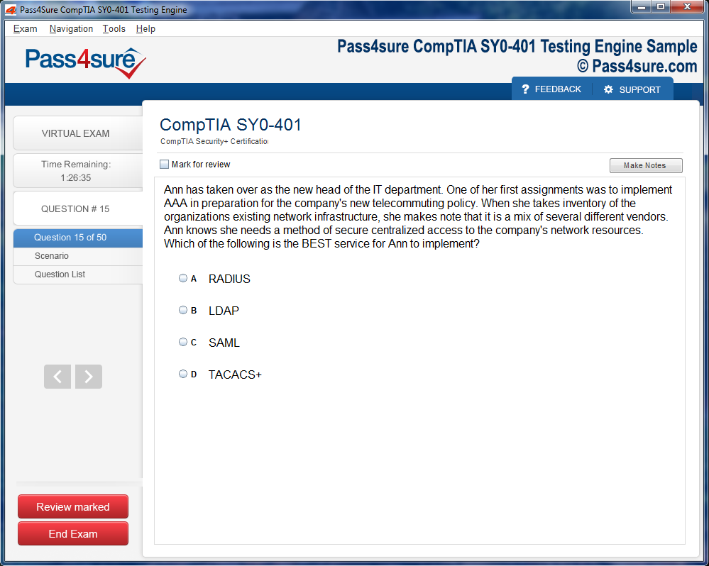
How does your testing engine works?
Once download and installed on your PC, you can practise test questions, review your questions & answers using two different options 'practice exam' and 'virtual exam'. Virtual Exam - test yourself with exam questions with a time limit, as if you are taking exams in the Prometric or VUE testing centre. Practice exam - review exam questions one by one, see correct answers and explanations).
How can I get the products after purchase?
All products are available for download immediately from your Member's Area. Once you have made the payment, you will be transferred to Member's Area where you can login and download the products you have purchased to your computer.
How long can I use my product? Will it be valid forever?
Pass4sure products have a validity of 90 days from the date of purchase. This means that any updates to the products, including but not limited to new questions, or updates and changes by our editing team, will be automatically downloaded on to computer to make sure that you get latest exam prep materials during those 90 days.
Can I renew my product if when it's expired?
Yes, when the 90 days of your product validity are over, you have the option of renewing your expired products with a 30% discount. This can be done in your Member's Area.
Please note that you will not be able to use the product after it has expired if you don't renew it.
How often are the questions updated?
We always try to provide the latest pool of questions, Updates in the questions depend on the changes in actual pool of questions by different vendors. As soon as we know about the change in the exam question pool we try our best to update the products as fast as possible.
How many computers I can download Pass4sure software on?
You can download the Pass4sure products on the maximum number of 2 (two) computers or devices. If you need to use the software on more than two machines, you can purchase this option separately. Please email sales@pass4sure.com if you need to use more than 5 (five) computers.
What are the system requirements?
Minimum System Requirements:
- Windows XP or newer operating system
- Java Version 8 or newer
- 1+ GHz processor
- 1 GB Ram
- 50 MB available hard disk typically (products may vary)
What operating systems are supported by your Testing Engine software?
Our testing engine is supported by Windows. Andriod and IOS software is currently under development.